New Delhi’s decision to assign official names to 27 locations in Arunachal Pradesh has brought a long-standing territorial dispute with China back into sharp focus, coming just a day after officials from the two countries met in the Indian capital to discuss border management and reaffirm the need for peace along the Line of Actual Control.
The move, reported by the South China Morning Post, involves locations that include villages, mountain passes, a high-altitude lake and a memorial, some of them close to the disputed frontier. India says the standardised names are intended to ensure “accurate recognition” and improve public awareness of the geographical and historical significance of the locations. Beijing, however, has rejected the move as illegitimate and reiterated its claim over the entire region.
The timing has added sensitivity to the decision. On Thursday, senior diplomats from India and China co-chaired the 36th meeting of the Working Mechanism for Consultation and Coordination on China-India Border Affairs in New Delhi. Representatives from defence, home affairs and immigration agencies also participated. According to China’s foreign ministry, the discussions covered border management, cross-border cooperation and official demarcation, while both sides agreed to prepare for the next round of special representative talks and maintain communication through diplomatic and military channels.
The following day, India announced the new names through its official mapping system. The Survey of India list covers 21 land areas, four mountain passes, a high-altitude lake and a memorial. Among the locations are Longju, the site of a 1959 border confrontation, and the nearby villages of Maja and Bisa. The list also includes Thag La, a strategically important mountain pass where the 1962 border war between India and China erupted.
Another location is the Sher-e-Thapa Memorial, commemorating an Indian soldier who fought in that conflict, while Sambho Sarovar, a high-altitude lake, is also included. Three of the locations named by India – Longju, Maja and Bisa – are currently under Chinese control, according to the supplied South China Morning Post report.
Beijing has long referred to Arunachal Pradesh as Zangnan, or southern Tibet. On Monday, Chinese foreign ministry spokesman Guo Jiakun rejected India’s action, declaring that “Zangnan region is China’s territory”.
“China does not recognise the so-called Arunachal Pradesh illegally set up by India. India’s [attempt] to replace names long used by China with its so-called standard names is illegal, null and void. Still less will it change the fact that Zangnan region belongs to China,” Guo said.
The dispute over names reflects a much broader disagreement over sovereignty. Beijing rejects Indian sovereignty over Arunachal Pradesh, which borders China’s Tibet autonomous region, and claims the territory as historically part of China. India, meanwhile, has consistently rejected Chinese attempts to rename locations in the state.
Indian media described New Delhi’s latest move as a response to Beijing’s mapping campaign, which began in 2017. According to the state-owned Global Times, China’s Ministry of Civil Affairs has issued six lists of standardised names covering 112 locations, including villages, mountain passes, rivers and peaks.
India’s Ministry of External Affairs has repeatedly dismissed those Chinese renaming exercises. On Saturday, spokesman Randhir Jaiswal described them as “vain and preposterous”.
“Arunachal Pradesh was, is, and will always remain an integral and inalienable part of India. Assigning invented names will not alter this reality,” he said.
The competing use of official maps and place names has therefore become another expression of the unresolved territorial dispute. Liu Zongyi, a senior fellow at the Shanghai Institutes for International Studies, said India’s latest action was “primarily aimed at reinforcing its territorial claims” and creating the impression that its sovereignty over Arunachal Pradesh was already settled.
Liu said the exercise was based on what Beijing considers the “illegal McMahon Line” and built on India’s 1987 establishment of the “so-called Arunachal Pradesh”. He argued that the move served both external and domestic purposes, allowing New Delhi to declare sovereignty over locations including some under China’s actual control while reinforcing the perception inside India that the territory was beyond dispute.
Several of the locations, Liu said, had “clear military and strategic significance”, including mountain passes and logistical hubs that could support future Indian deployments and infrastructure projects. He also viewed the inclusion of the war memorial as reflecting an element of “political education and nationalist messaging”.
“In essence, India is using maps and place names to construct a narrative of expansion, relying on its own mythology rather than established international norms,” Liu said.
He contrasted that with China’s approach, which he argued was based on sovereignty and historical legitimacy and on Beijing’s rejection of the British colonial-era McMahon Line, regarded by India as the basis of its eastern boundary with China. “By publishing standardised names, China reaffirms its sovereignty over Zangnan to the international community and underscores its right to exercise lawful authority there in the future,” Liu said.
The dispute remains unresolved after decades of competing territorial claims. Pending a comprehensive border settlement, India and China have fought a war and experienced several deadly clashes over their differing perceptions of the Line of Actual Control.
For Liu, the latest naming controversy demonstrates that New Delhi’s position on the territorial dispute remains entrenched despite recent efforts to improve bilateral relations.
“Rather than seeking resolution through negotiation, it attempts to legitimise its occupation by asserting ‘possession itself equals sovereignty’. This shows that, despite outward gestures of easing relations, India’s stance on fundamental questions remains unchanged,” Liu said.
Yet the naming dispute comes at a moment when both governments have been attempting to sustain a cautious improvement in relations after years of tension along the Himalayan frontier. India is preparing to host next month’s summit for Brics, the bloc of emerging economies that also includes China. Special representatives from the two countries are also expected to hold their 25th round of boundary talks in Beijing in the coming months.
There have been limited signs of practical engagement. Border trade through Nathu La resumed on August 1 after a six-year suspension. At a July 22 meeting in Manila, Chinese Foreign Minister Wang Yi and Indian Minister of External Affairs Subrahmanyam Jaishankar pledged to consolidate positive momentum in bilateral ties.
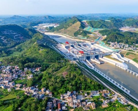
At the same time, the border remains a source of wider strategic concerns. During the New Delhi talks, India urged China to resume sharing hydrological data amid concerns over Beijing’s construction of a massive dam on the Yarlung Tsangpo (Brahmaputra) River, about 50km (31 miles) from the Arunachal Pradesh border, according to Bloomberg.
The juxtaposition is striking: diplomatic channels are being maintained, practical engagement is gradually returning and preparations are under way for further negotiations, while the two sides continue to assert fundamentally incompatible claims over the same frontier.
The 27 newly named locations do not resolve that dispute. Instead, they place the contested geography directly into the official maps and public narratives of both countries, illustrating how deeply questions of territory, history and sovereignty remain embedded in the relationship. As India and China attempt to preserve their cautious thaw, the Himalayan frontier continues to demonstrate how easily efforts at stabilisation can collide with the unresolved foundations of their boundary dispute.