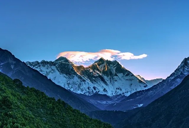
The disaster that struck the Nepal-China border on August 26 has forced scientists to reconsider how high-mountain hazards are assessed. What began with the collapse of a glacier-rock system near Langtang Lirung rapidly developed into a destructive torrent of ice, rock, mud and water, travelling 22km down a valley before reaching the Gyirong Port border crossing in China.
The human toll continues to rise. China reported 21 deaths and 541 people missing as of Wednesday after the glacier collapsed on the Nepalese side of the border. In Nepal, the death toll had reached 1,114 by Wednesday afternoon, with about 3,900 people still missing.
But the disaster has also raised a question that extends beyond this single catastrophe: what happens when the failure of a glacier is only the first stage of a much larger disaster?
Gao Rong, deputy director of China’s National Climate Centre, said at a press briefing on Wednesday that the glacier system across the Tibetan Plateau is becoming increasingly unstable.
“Over the past 60 years, the glacier area on the Tibetan Plateau has shrunk by around 24 per cent, with around 7,000 small glaciers disappearing completely,” Gao said.
The warning was stark.
“Looking ahead, the structural stability of glaciers across the Tibetan Plateau will decline further. Glacial disasters are likely to become more frequent and could amplify in destruction and reach through cascading effects.”
The distinction is crucial. The danger does not necessarily end when ice and rock break away from a mountain. Once material begins moving downhill, it can gather additional debris, water and sediment, multiplying the scale of the original failure.
That process was central to the destruction along the valley leading towards Gyirong Port.
A study released on Tuesday by researchers led by the Institute of Tibetan Plateau Research at the Chinese Academy of Sciences, together with the Chinese University of Hong Kong, Wuhan University and other institutions, found that downstream erosion was critical to the eventual scale of the disaster.
Using satellite and field data from Gyirong County, the researchers found that the collapsing ice and rock swept down the 22km valley, scoured the riverbed and dragged material from the banks into the flow. As water became mixed with the accumulating debris, the original high-elevation collapse was transformed into a devastating mudslide.
The finding challenges a conventional approach to assessing hazards in high mountain regions.
Scientists have traditionally placed significant emphasis on the volume of material involved in an initial collapse. But the research indicates that this may tell only part of the story. A smaller collapse can become far more destructive if the valley through which it travels allows it to accumulate enormous quantities of additional material.
The researchers therefore argue that future assessments must take account of what they describe as the valley’s “bulking potential” — its capacity to increase the size of a landslide as it moves downhill — as well as the people and infrastructure exposed further downstream.
“What truly determines risk is not just how much collapsed on the mountain, but how much can be entrained in the gully, and what critical infrastructure and populations downstream are exposed to the hazard chain,” the researchers said.
The implications extend well beyond the immediate disaster zone.
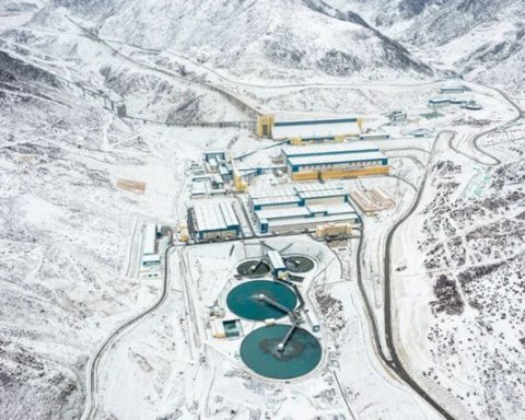
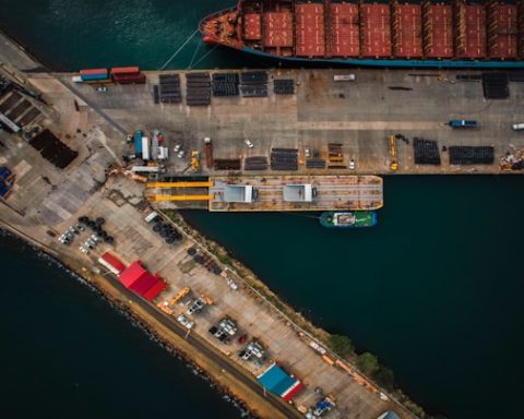
The mudslide travelled 22km along the valley and reached Gyirong Port in just seven minutes, according to an initial assessment released last week. The speed left little opportunity for those in its path to respond once the collapse had begun.
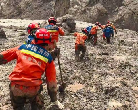
For China, the disaster has also created an enormous logistical challenge. After seven days, Beijing cleared the road to Gyirong Port, the hardest-hit area on the Chinese side. Heavy machinery was then able to reach the checkpoint area to assist with deeper search and recovery operations.
China has also increased cross-border assistance to Nepal. Guo Jiakun, a foreign ministry spokesman, said China’s second batch of emergency supplies arrived in Kathmandu on Tuesday afternoon, accompanied by five DNA identification experts. A third shipment and a second expert team were being prepared.
Yet the disaster has exposed another weakness: the difficulty of detecting an event before it begins.
An article published in Nature on Wednesday highlighted the urgent need to upgrade monitoring and forecasting systems for future disasters. The event was particularly difficult to predict because it was triggered by the sudden failure of a high-altitude glacier-rock system rather than by more familiar warning signs such as extreme rainfall or rising glacial lakes.
Manoochehr Shirzaei, a geophysicist at Virginia Tech in Blacksburg, told Nature that conventional monitoring tools had fallen short in predicting such disasters.
The problem, he argued, is not simply a lack of information but the absence of systems capable of connecting different forms of information quickly enough to identify an approaching disaster.
“What is still largely missing is a regional satellite-based system that routinely searches for accelerating glacier and rock-slope deformation and then connects that information directly to downstream flood and avalanche modelling,” Shirzaei said.
That gap matters because the latest disaster demonstrates how quickly separate hazards can merge into a single chain of destruction. A glacier collapse can trigger a landslide; the landslide can erode a valley; the debris can mix with water; and the resulting flow can travel far beyond the original point of failure.
By the time the danger becomes visible downstream, the process may already be unstoppable.
The continuing search operations in Nepal and China therefore carry significance beyond the immediate recovery effort. They are also providing scientists with evidence about how high-mountain disasters evolve — and why measuring only what falls from a mountain may give an incomplete picture of the danger.
The Tibetan Plateau has already lost around 24 per cent of its glacier area over the past six decades, according to China’s National Climate Centre. With thousands of small glaciers having disappeared completely, scientists are now warning that the structural stability of remaining glaciers could decline further.
The lesson from the August 26 catastrophe is consequently more complicated than the simple image of a glacier collapsing.
The most destructive part of the disaster may happen after the ice and rock leave the mountain.
For communities, roads and critical infrastructure downstream, the real threat lies in what that initial collapse becomes as it moves through the valleys — gathering debris, water and force until a high-altitude failure becomes a disaster capable of crossing borders.
The challenge now is to detect not merely when a mountain begins to fail, but how far the consequences of that failure can travel.