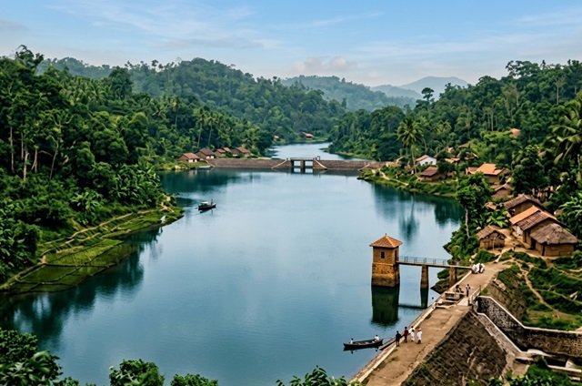
In Ratnapura district, the Kalatuwawa Reservoir has revealed a long-lost village as water levels have dropped by 38.5 feet due to dry weather in March 2026. The reservoir, an artificial water body built in 1954, submerged the entire village of Kalatuwawa, including homes, a walawwa, a temple, a school, a market, a post office, a dispensary, and the old Ratnapura-Colombo road. As the water recedes, ruins of the village and the old roadway are visible, providing a rare glimpse into a settlement that has been underwater for more than seventy years.
Kalatuwawa village was historically governed by Korale of Kalatuwa, Habarakada Arachchilage Don Haramanis Kalatuwawa. Korale was a mid-19th century local leader with authority over law enforcement and forest management. He was known for strict discipline and for enforcing rules against trespassing, including punishing British officials, foreign engineers, and local hunters who violated the Kalatuwa forest reserve. Korale also maintained religious and conservation rules, such as forbidding the killing of fish in the Kalatuwa Oya.
In the early 20th century, British engineers surveyed the area to identify a suitable site for a reservoir to supply Colombo. When Korale disciplined the engineers for entering the forest without permission, local accounts suggest that colonial authorities took this as an act of defiance. Villagers report that the decision to build the Kalatuwawa Reservoir was influenced in part by a desire to punish Korale. The construction submerged his walawwa, the village, and all associated property. Korale fell ill and died a few months after the flooding.
The need for a new reservoir arose from Colombo’s repeated water shortages. The Labugama Reservoir, completed in 1886, initially supplied water to the city, but by the early 20th century it had become insufficient. Population growth and development in Colombo and surrounding suburbs increased water demand. Authorities identified the Kalatuwawa Oya, a stream northeast of Labugama, as a potential water source capable of meeting the city’s growing needs.
Approval for the project was granted in 1934, but construction began in 1949. Financial assistance was provided by the Republic of Hungary. British engineers oversaw the project, combining modern engineering techniques with local knowledge of irrigation and stonemasonry. Granite blocks were used to construct the main dam, combining concrete and earth embankments to ensure stability. Local stonemasons contributed labor and expertise throughout the project.
The Kalatuwawa Reservoir covers 454 acres, with a watershed of approximately 3,500 acres. It has three dams. The main dam is 980 feet long, 80 feet high, and 8 feet wide at the top. About 710 feet of the main dam is concrete, with the remainder consisting of earth embankments. The second dam, across the Mapotha Oya, is 415 feet long and 20 feet high. The third, at Napawala, is 375 feet long and 37 feet high. The reservoir was completed in 1954 and filled in 1955.
Water from Kalatuwawa flows to the Kalatuwawa Water Treatment Plant, located more than 370 feet above sea level. The water moves by gravity from the reservoir to the treatment plant and is then supplied to Colombo and surrounding suburbs. The reservoir releases approximately 2 million gallons of water per day, nearly twice the daily output of the Labugama Reservoir.
The area around the reservoir is part of the Labugama-Kalatuwawa Forest Reserve, the largest forest reserve in the Colombo District, covering 2,150 hectares. The region includes Udagama Mountain, which rises to 1,482 feet, and is characterized by wet-zone evergreen rainforest. The reservoir itself is surrounded by mountain gorges, forested valleys, and water gorges, creating a natural environment that supports diverse wildlife.
Before the reservoir, Kalatuwawa village was connected to a main by-road linking Ratnapura and Colombo via Kaluaggala, Thummodara, Kalatuwawa, Uduwaka, Iddamalgoda, and Gatahetta. Parts of this road are still visible today when the reservoir’s water level drops. The village had houses, a market, a school, a post office, and a temple. All of these were submerged when the reservoir was filled.
Korale of Kalatuwa was the most powerful figure in the area during his time. He lived in a walawwa with 23 rooms and maintained control over the forest reserve. He punished anyone who violated rules, regardless of their rank, and enforced conservation regulations. His opposition to unauthorized activities in the forest brought him into conflict with British authorities and visiting engineers. The reservoir’s construction is widely remembered by local residents as a measure that erased Korale’s property and authority.
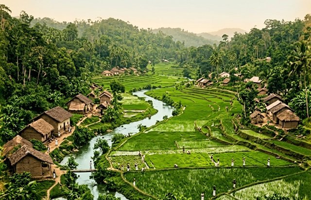
The reservoir solved Colombo’s water shortages but came at the cost of a village and a community. Families were displaced, and the material and cultural legacy of the village was destroyed. Local accounts indicate that the reservoir’s location was chosen in part to punish Korale for his defiance, making the project not only a water solution but also an act of control and retribution.
During construction, local stonemasons were employed alongside British engineers. Granite blocks of varying sizes were arranged uniformly to create a strong and durable dam. The main dam measures 980 feet in length, with a combination of concrete and earth embankments. The Mapotha Oya dam is 415 feet long and 20 feet high, while the Napawala dam is 375 feet long and 37 feet high.
The Kalatuwawa Reservoir today remains critical to Colombo’s water infrastructure. It releases nearly 84,000 cubic meters of water daily, feeding the city’s treatment systems. It functions alongside Labugama Reservoir, which releases approximately 1.2 million gallons per day. Together, the two reservoirs provide a major portion of Colombo’s water supply.
When water levels are low, the submerged ruins of Kalatuwawa become visible. Foundations of buildings, roads, and other structures can be seen, reminding residents and visitors of the village that was erased. These visible remains provide historical evidence of both the human cost of the reservoir and the local legend surrounding Korale’s defiance and the colonial response.
The story of Kalatuwawa is therefore twofold: it is a technical achievement in water management and a cautionary account of displacement, power, and colonial influence. The reservoir addressed urgent infrastructure needs, but it also destroyed a community and erased the authority of a local leader.
As droughts continue and water levels fluctuate, more of the submerged village may resurface. Each exposure serves as a reminder of what was lost when the reservoir was created. Kalatuwawa remains an essential water source for Colombo, but it also tells a story of human cost and historical consequence.