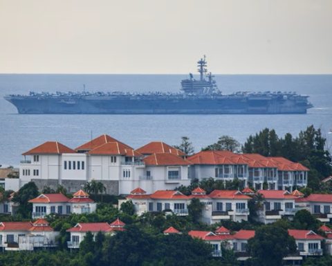
The USS Tripoli, an 844-foot amphibious assault ship, was observed making a brief port call at Diego Garcia in the Indian Ocean as it raced toward the Middle East to support the ongoing U.S.-Israeli war against Iran, according to satellite imagery reported by Newsweek. The vessel, carrying over 2,000 Marines and equipped with F‑35B Lightning II stealth fighters, represents a significant escalation of American military presence in the region. Images captured by the AI startup MizarVision, which specializes in geospatial intelligence, show the Tripoli docked at the remote U.S.-U.K. base, likely topping off fuel and supplies before entering the U.S. Central Command area of operations later this week.
Diego Garcia, located roughly 450 miles south of the Maldives, has served as a strategic hub for U.S. and British forces, supporting bombing operations against Iran and the Yemen-based Houthis since 2024. British officials reported that Tehran had attempted ballistic missile strikes on the base, though these attacks were unsuccessful. The Tripoli departed the South China Sea last week, sailing southwest under escort from at least two destroyers, while another Japan-based vessel, the USS San Diego, appears to be following along, according to open-source intelligence analysts.
Newsweek notes that the Tripoli’s deployment comes at a cost to U.S. military posture in the Asia-Pacific. In addition to moving warships to the Middle East, the Pentagon has pulled the THAAD missile defense system from South Korea, as Iranian counterattacks deplete U.S. and Israeli missile interceptors. Analysts indicate that the Tripoli’s arrival, expected this Friday, will bolster U.S. firepower in the region, although the broader fleet composition and location remain uncertain.
Satellite imagery has become an increasingly important tool for monitoring global conflicts, though commercial providers often restrict public access during wartime to prevent operational intelligence from falling into adversary hands. Newsweek reports that companies such as Vantor and Planet Labs voluntarily delayed the release of high-resolution images over U.S. and NATO sites, citing security concerns. SkyFi CEO Luke Fischer explained that these precautions prioritize real-time access for national security officials while limiting the potential misuse of imagery by hostile actors.
Analysts and OSINT experts emphasize that while satellite imagery offers unprecedented visibility into military operations, the delays in commercial data dissemination provide a critical buffer that protects forces and assets. Joseph Wen, co-founder of the Taiwan Defense Studies Initiative, told Newsweek that the standard 14-day delay allows military units to reposition, camouflage, or evacuate before imagery becomes publicly accessible, effectively preventing real-time reconnaissance from aiding Iran or its proxies.
The surge of U.S. forces, led by the Tripoli, underscores the intensity and global implications of the conflict, as well as the evolving role of satellite technology in modern warfare. According to Newsweek, the deployment illustrates how the U.S. leverages both conventional forces and intelligence-gathering capabilities to project power while balancing operational security in an era of open-source surveillance and real-time satellite observation.